| CroninProjects.org/ Jahns/ FindingActiveFaults/ |
|---|
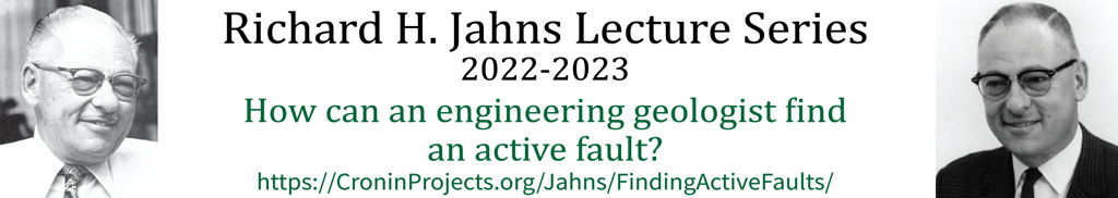
Description
This talk will summarize techniques my students and I use to find the ground-surface trace of seismogenic/active faults. It will emphasize the ideas of geoscience to benefit society, the primacy principle of protecting human life/safety, the comingling of basic fieldwork with analysis of geophysical data (relocated earthquake hypocenter data, earthquake focal mechanisms, GPS geodesy, LiDAR-based geomorphic analysis), and the virtue of continuing education throughout a geoscientist's career.
Some Resources
References
Ashburn, J.A., 2015, Investigation of a lineament that might mark the ground-surface trace of the Dog Valley fault, Truckee area, northern California: Baylor University Geology Department, defended 13 July 2015, accessible via https://CroninProjects.org/Vince/AshburnBSThesis2015.pdf.
Cronin, V.S., 2004, A draft primer on focal mechanism solutions for geologists: Teaching Quantitative Skills in the Geosciences, https://serc.carleton.edu/files/NAGTWorkshops/structure04/Focal_mechanism_primer.pdf
Cronin, V.S., 2008, Finding the mean and 95 percent confidence interval of a set of strike-and-dip or lineation data: Environmental and Engineering Geoscience, v. XIV, no. 2, p. 113-119.
Cronin, V.S., 2014, Seismo-Lineament Analysis Method (SLAM), using earthquake focal mechanisms to help recognize seismogenic faults: Proceedings of the 5th International INQUA meeting on Paleoseismology, Active Tectonics and Archeoseismology (PATA Days), 21-27 September, Busan, South Korea, p. 21-27 September 2014, p. 28-31, ISBN 9791195344109 93450; available via https://CroninProjects.org/Vince/SLAM/CroninINQUA_PATA14.pdf.
Cronin, V.S., Millard, M.A., Seidman, L.E., and Bayliss, B.G., 2008, The Seismo-Lineament Analysis Method [SLAM] for finding seismogenic faults: Environmental and Engineering Geoscience, v. 14, no. 3, p. 199-219.
Fisher, R.A., 1953, Dispersion on a sphere: Proceedings Royal Society, London, v. A217, no. 1130. p. 295-305.
Hobart, C., 2021, Selecting locations for future geophysical surveys in search of the Dog Valley fault using earthquake, LiDAR, and GPS data: MS research, Baylor University, accessible via https://baylor-ir.tdl.org/handle/2104/11697.
Johnson, A.M., Burnham, C.W., Allen, C.R., and Muehlberger, W. [editors], 1990, Richard H. Jahns Memorial Volume -- A selection of papers presented in honor of his memory by his students: Elsevier, 594 p. and 5 plates.
Lindsay, R., 2011, Applying SLAM to recognize seismogenic faults in the Tahoe Basin area of California and Nevada: MS research, Baylor University, accessible via https://baylor-ir.tdl.org/handle/2104/11697.
Logan, J.M., Friedman, M., Higgs, N., Dengo, C., and Shimamoto, T., 1979, Experimental studies of simulated gouge and their application to studies of natural fault zones, in Analysis of actual fault zones in bedrock: U.S. Geological Survey, Open-File Report 79-1239, p. 305-343, accessible via https://pubs.usgs.gov/of/1979/of79-1239/
McCalpin, J.P., [editor], 2009, Paleooseismology [2nd edition]: Academic Press, Elsevier Science, 629 p., ISBN-13 9780080919980
NCEDC, 2023, Northern California earthquake data center: available via http://quake.geo.berkeley.edu/ncedc/catalog-search.html.
OpenTopography.org -- 2014 USFS Tahoe National Forest Lidar CA1-Guo
Reasenberg, P.A., and Oppenheimer, D., 1985, FPFIT, FPPLOT, and FPPAGE: Fortran computer programs for calculating and displaying earthquake fault-plane solutions: U.S. Geological Survey, Open-File Report, no. 85-739.
Reed, T., 2014, Spatial correlation of earthquakes with two known and two suspected seismogenic faults, north Tahoe-Truckee area, California: MS research, Baylor University, accessible via https://baylor-ir.tdl.org/handle/2104/9097.
Scholz, C.H., 2018, The mechanics of earthquakes and faulting [3rd edition]: Cambridge, Cambridge University Press, 512 p., doi:10.1017/9781316681473, ISBN-13 978-1316615232
Strasser, M., 2017, Spatial correlation of selected earthquakes with the Dog Valley fault in northern California using LiDAR and GPS data: MS research, Baylor University, accessible via https://baylor-ir.tdl.org/handle/2104/10134.
USGS, 2023, Quaternary fault and fold database of the United States: available via https://www.usgs.gov/programs/earthquake-hazards/faults and https://usgs.maps.arcgis.com/apps/webappviewer/index.html?id=5a6038b3a1684561a9b0aadf88412fcf
Waldhauser, F. and Schaff, D.P., 2008, Large-scale relocation of two decades of northern California seismicity using cross-correlation and double-difference methods: Journal of Geophysical Research, v. 113, B08311, doi: 10.1029/2007JB005479.
Waldhauser, F., 2001, hypoDD -- A program to compute double-difference hypocenter locations: U.S. Geological Survey, Open-File Report 01-113, 25 p. , accessible via https://www.usgs.gov/publications/hypodd-a-program-compute-double-difference-hypocenter-locations
Waldhauser, F., 2009, Near-real-time double-difference event location using long-term seismic archives, with application to northern California: Bulletin of the Seismic Society of America, v. 99, no. 5, pp. 2736-2748, doi: 10.1785/0120080294.
Waldhauser, F., 2017, Real-time double-difference earthquake locations for northern California, available via http://ddrt.ldeo.columbia.edu/DDRT/index.html.
| Return to the homepage for the Jahns Lecture Series, 2022-23 |
|---|
If you have any questions or comments about this site or its contents, drop an email to Vince Cronin.